
Tampa–Orlando Corridor Braces for Rare Snow Flurries as Arctic Air Pushes Deep Into Florida
FLORIDA — Snow chances are increasing across central Florida, with forecasters now tracking the possibility of snow flurries — and even a light dusting in spots — from the Tampa Bay area to Orlando late Saturday into Sunday as an unusually cold Arctic air mass collides with moisture from the Gulf of Mexico.
Why Snow Is Suddenly on the Table in Florida
Forecast models show strong north-to-northeast winds pulling frigid air straight into the peninsula behind an Arctic front. At the same time, Gulf-effect moisture may stream inland near the west coast, creating narrow bands of wintry precipitation — a setup rarely seen this far south.
High-resolution guidance indicates:
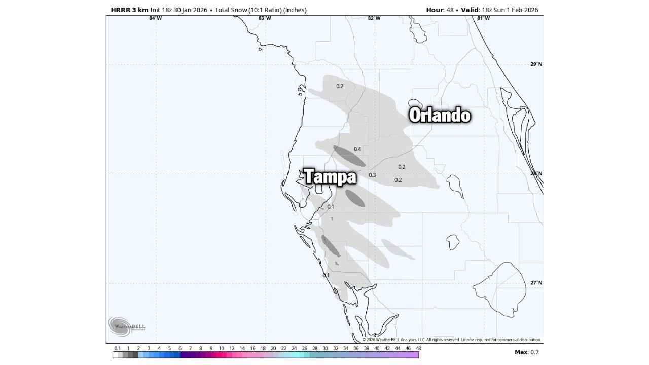
- Snow flurries possible from Tampa through Orlando
- Localized light accumulation where snow showers overlap, mainly near and south of Tampa
- Many locations seeing brief flurries only, with no measurable snow
While amounts appear minimal, even a trace of snow would be remarkable for central Florida.
Tampa Bay Has the Best Shot at Seeing Accumulation
The latest model output highlights Tampa Bay and nearby coastal areas as the most likely zone for brief accumulation due to Gulf-effect snow bands rotating onshore. Forecast shading suggests:
- Up to a few tenths of an inch in isolated pockets
- Rapid melting after sunrise due to ground temperatures and February sun angle
Orlando and areas east are more likely to see flakes in the air rather than accumulation, but visibility reductions are possible during heavier bursts.
Temperatures Will Be Cold Enough to Support Snow
This event is being driven by an exceptionally cold air mass for Florida, with overnight temperatures falling into ranges that can briefly support snow:
- Surface temperatures near or just above freezing
- Wind chills making it feel even colder
- Cold, dry air aloft enhancing snowflake survival to the ground
Forecasters stress that timing and band placement will be critical, and small shifts could mean the difference between flurries and a dusting.
What Residents Should Know
- Travel impacts are expected to be minimal, but bridges could briefly become slick if snow sticks
- Pets, plants, and exposed pipes should be protected due to the cold
- Snow sightings would likely be short-lived and highly localized
A Rare Florida Weather Moment
Snow in central Florida is extremely uncommon, and even flurries generate widespread attention. While this is not shaping up to be a major winter storm, it is one of the most unusual cold-and-snow setups Florida has seen in years.
What do you think — will Tampa or Orlando actually see snowflakes this weekend? Share what you’re seeing on the ground and stay with WaldronNews for real-time updates as this rare Florida cold snap unfolds.