
Northern Mississippi and Northern Alabama Added to 5% Tornado Risk as Forecast Signals Environment Capable of Multiple Twisters This Afternoon and Evening
MISSISSIPPI — Forecasters have expanded the tornado outlook to include a 5% risk area across northern Mississippi and northern Alabama for this afternoon and evening, citing an increasingly supportive environment for at least a couple of tornadoes.
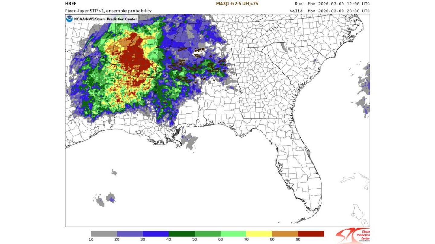
Updated high-resolution ensemble guidance shows strengthening ingredients across the region, prompting what meteorologists describe as a prudent expansion of the tornado probability zone.
Why the 5% Risk Was Added
The newly highlighted area covers portions of northern Mississippi extending east into northern Alabama. Forecast models indicate:
- Increasing low-level wind shear
- Strengthening instability
- Favorable storm-relative helicity values
Ensemble “paintball” guidance suggests multiple members generating rotating storm structures across this corridor, reinforcing the potential for supercells capable of producing tornadoes.
The fixed-layer Significant Tornado Parameter (STP) probabilities further support concern, with elevated values spreading across Mississippi into Alabama during peak heating hours.
At Least a Couple Tornadoes Possible
The current environment suggests more than a marginal setup. The wording from forecasters indicates confidence that at least a couple tornadoes could develop within the 5% zone.
Northern Mississippi appears to be near the western edge of the strongest model signal, with northern Alabama included as storms track eastward through the afternoon and evening.
Storm mode will be critical. Discrete or semi-discrete cells ahead of any larger line could pose the greatest tornado threat.
Conditional Risk Further South
While northern Mississippi and northern Alabama carry the more defined 5% tornado risk, areas farther south remain in a more conditional setup.
Forecasters caution that if a “surprise” storm were to develop and mature farther south — where instability may be stronger but forcing less certain — a tornado threat could quickly materialize there as well.
That means communities outside the highlighted 5% area should not dismiss the potential entirely.
Timing and Storm Evolution
Model guidance valid through late afternoon and early evening shows the highest probabilities aligning during peak heating, before storms potentially consolidate into a more linear structure later tonight.
Key areas to monitor include:
- Northern Mississippi counties near the Tennessee border
- Northern Alabama, including areas west of Birmingham
As storms intensify, rotating updrafts may become more organized in localized pockets.
Stay Alert Regardless of Risk Level
Even a 5% tornado probability represents a meaningful threat, particularly when guidance signals a supportive environment for multiple tornadoes.
Residents across northern Mississippi and northern Alabama should:
- Monitor watches and warnings closely
- Ensure multiple ways to receive alerts
- Have a shelter plan ready
Weather conditions can evolve rapidly, especially in early-season severe setups.
WaldronNews.com will continue monitoring developments as storms begin to organize this afternoon and evening. Stay weather-aware and prepared as this evolving tornado threat unfolds across the region.