
Powerful Wind Event and Escalating Fire Weather Threat Target Jefferson, Boulder, Broomfield, Larimer, and Weld Counties Beginning Thursday in Colorado
COLORADO — A significant stretch of unseasonably warm, dry, and increasingly windy weather is setting the stage for elevated to potentially critical fire weather conditions across northern Colorado, with the most concerning impacts expected beginning Thursday, March 12.
Jefferson, Boulder, Broomfield, Larimer, and Weld counties are specifically highlighted as areas where strong winds could heighten wildfire danger and increase the risk of power outages due to potential damage to electrical infrastructure.
Warm and Breezy Pattern Already Underway
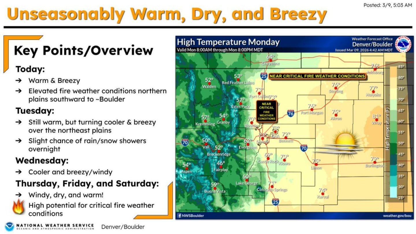
Early-week conditions across the Denver/Boulder region have featured warmer-than-normal temperatures and breezy afternoons. Elevated fire weather conditions have already developed across the northern plains southward toward Boulder.
High temperatures across the eastern plains and I-25 corridor have climbed well above seasonal averages, while foothill and mountain communities have remained cooler but increasingly breezy.
Tuesday brings continued warmth, though cooler air may briefly filter into the northeast plains along with a slight chance of rain or snow showers overnight. By Wednesday, cooler and breezy conditions spread across parts of the area before a much more impactful wind event develops.
Thursday Marks a Turning Point
Beginning Thursday, strong winds are forecast to expand across:
- All plains
- Most foothill communities
- Jefferson County
- Boulder County
- Broomfield County
- Larimer County
- Weld County
Forecast messaging highlights “very windy” conditions Thursday, with continued gusty and warm weather into Friday.
Low relative humidity — potentially dropping below 15% and even near or under 10% in some areas — combined with gusty winds exceeding 25 mph will create conditions highly favorable for rapid fire spread.
Escalating Fire Weather Categories
The outlook shows a progression of fire weather concerns:
- Near Critical Conditions early in the week in parts of Boulder County and along the northern border
- Critical Conditions midweek across the northeast plains
- Extremely Critical Conditions possible Thursday and Friday across broad portions of the plains and foothills
Extremely critical fire weather typically involves very low humidity, strong and erratic winds, and very dry fuels — a combination that can cause fires to spread quickly and unpredictably.
Power Outage Risk Increases
In addition to wildfire concerns, strong winds may pose a risk to power infrastructure across the affected counties. Damaged lines or preventive safety shutoffs could lead to outages, particularly in areas with high fire danger.
Residents are encouraged to prepare now, especially those who rely on electrically powered medical equipment. Backup power plans and emergency kits should be reviewed before winds intensify.
Weekend Outlook
Windy and warm conditions are expected to continue into Friday, with lingering fire weather concerns possible into Saturday depending on wind speeds and humidity trends.
The combination of unseasonably warm temperatures, dry air, and strengthening winds makes this one of the more concerning fire weather setups of the early spring season across northern Colorado.
WaldronNews.com will continue monitoring updates as Thursday’s wind event approaches and fire weather conditions evolve across Jefferson, Boulder, Broomfield, Larimer, and Weld counties.