
Supercells Screaming Toward Kansas and Oklahoma This Afternoon as 60-Knot Jet and Deep Moisture Load the Dryline
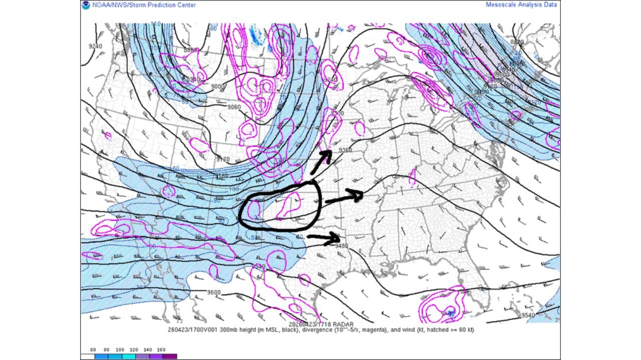
WICHITA, Kansas — The atmosphere over Kansas and Oklahoma this afternoon is about as primed for supercell thunderstorms as it gets. Upper air maps are painting a near-perfect severe weather setup — a 50 to 60 knot jet stream aimed directly at the dryline, deep moisture surging across the entire warm sector with dewpoints hitting 12°C, and a powerful shortwave disturbance approaching from the west. When these ingredients come together like this, rotating supercells are not a possibility — they are an expectation.
Forecasters are describing this as a near-certainty for significant severe storm development along the Kansas-Oklahoma dryline this afternoon and evening.
States and Cities in the Immediate Threat Zone
- Kansas: Wichita, Hutchinson, Liberal, Dodge City — directly along the dryline where supercells are expected to fire first
- Oklahoma: Oklahoma City, Enid, Woodward, Ponca City — warm sector moisture deepest here; storm development explosive if cap allows
- Nebraska: Southern portions including McCook, North Platte — caught in the upper-level divergence zone pushing storms north
- Missouri: Western counties including Joplin, Kansas City — in the path as supercells track east through the evening
Primary Threats
- Rotating supercells — the upper-level setup is textbook for discrete, long-lived supercell development along and east of the dryline this afternoon
- 50–60 knot jet stream at the mid-levels aimed straight into the dryline — this is the engine powering storm organization and rotation
- Deep 12°C dewpoints across the entire warm sector — exceptional low-level moisture feeding directly into developing storms; the fuel tank is full
- Upper-level divergence spreading over the warm sector — this lifts the atmospheric lid and allows storms to explode upward rapidly
- 700mb shortwave approaching from the west — the trigger that will set storms in motion as it crosses the dryline boundary
Why This Matters for Kansas and Oklahoma
Here is what is happening in plain terms. The dryline is a boundary running north to south through western Kansas and Oklahoma — on the west side is dry desert air, on the east side is warm, humid Gulf moisture. When a powerful jet stream and an approaching disturbance collide at that boundary, thunderstorms ignite and immediately begin rotating because the wind is changing speed and direction dramatically with altitude.
Today, that collision is happening with an unusually clean and complete set of ingredients. The 50 to 60 knot jet at 300mb is providing the overhead energy. The shortwave at 700mb is providing the trigger. The deep moisture at 850mb — shown by the green dewpoint ribbon on the lower-level maps — is providing the fuel. And the divergence pattern spreading over the warm sector is removing the atmospheric lid that normally holds storms back.
Experienced forecasters use the phrase “slam dunk” only when a setup has essentially no weak links. Today’s Kansas-Oklahoma dryline setup has been called exactly that. Every layer of the atmosphere is cooperating simultaneously — the kind of alignment that produces the most organized, dangerous, and long-lived supercells of the season.
Wichita sits in the zone where the first supercells are most likely to fire and have the longest track ahead of them as they move east. Oklahoma City and the central Oklahoma warm sector have the deepest moisture but remain dependent on whether the afternoon heating breaks the cap — if it does, the storms there could be explosive.
Multi-Day Pattern
Today’s dryline event feeds directly into a multi-day severe weather stretch across the Central Plains and Mid-South. After tonight’s Kansas-Oklahoma supercells push east, the atmosphere reloads almost immediately for Monday, April 27 when Tennessee, Arkansas, and Mississippi face their own organized tornado threat. The same large-scale pattern driving today’s dryline storms is the engine behind the entire week of severe weather.
For Kansas and Oklahoma, today is the peak local threat window. Storm energy shifts east tonight and into the weekend, taking the most dangerous conditions toward the Mid-South by early next week.
What to Watch Next
- This afternoon from 3 to 7 PM is the primary initiation window — watch for the first supercell to fire along the Kansas dryline and track it closely
- Oklahoma City residents must monitor cap break timing — if storms fire in central Oklahoma, they will have access to the deepest moisture on the map
- Once supercells are established, tornado warnings can be issued with very little advance notice — have shelter ready before storms arrive, not after
- Track storm movement toward Wichita and east — storms initiated along the dryline will move northeast through populated corridors
- Monday’s Mid-South threat follows immediately — residents in Tennessee and Arkansas should be watching today’s Kansas storms and preparing for their own event this weekend
The atmosphere over Kansas and Oklahoma right now is loaded, triggered, and ready. This afternoon is a serious severe weather situation — treat every warning as life-threatening.
WaldronNews.com will continue tracking dryline supercell development across Kansas and Oklahoma and provide updates as storms fire this afternoon.